1. Pastures of Raschera
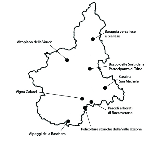
The area between Marguareis, Mongioie and Mondolé is one of the largest pasture areas in the province of Cuneo. The summer pastures of historical interest we have selected correspond to an area of about 878 ha located in the municipalities Frabosa Soprana, Frabosa Sottana and Magliano Alpi. The significance of the areas lies in the historical complexity of forage management in an area characterized by various transhumance systems. The areas are characterized by a high level of persistence of a particularly varied flora, resulting from the processes of biodiversification caused by shepherding (the number of the vegetal species identified in the Natural Park of Alta Valle Pesio e Tanaro is 1492, almost one fourth of the entire Italian flora). The local cheese Raschera di Alpeggio, obtained in 1982 the old DOC (Controlled Origin Denomination) label, and in 1996 the PDO label. The local toma made of unprocessed milk from Brigasca sheep is also present in the list of the Slow Food association. The landscape of the summer pastures of Raschera largely maintains its integrity. The reason lies in the enduring animal farming activities and in the open pastures, though the number of livestock is certainly much lower than in the past. In terms of vulnerabilities, the ecology of these summer pastures depends on their actual usage, which ensures the survival of the pastoral landscape and of its resources. The integrity of some pastures, in the past, has been damaged by the construction of ski slopes, by quarrying activities (now ended), and by the channelling of springs for aqueducts.
2. The plateau of the Vauda
The plateau of Vauda extends for about 3136 ha in the municipalities of Front, Vauda Canavese, San Carlo Canavese, San Francesco al Campo, Lombardore, Rivarossa and Nole. Besides its historical persistence, the significance of the landscape of Vauda is due also to its particular morphology which isolates its vast surface from the surrounding terrain, as well as to the vast extension of the incolto (uncultivated land). In the more northern part of the area, there are vast woods, mainly made of oaks, alders, and beeches, which tend to thin out towards the flatter central and southern parts. Here extensive patches of plain moorland, with a great varieties of grass species, poplar groves and birch groves, alternate with vast extensions of forage meadows and cultivated areas, especially cereals (corn and wheat, but also, albeit is increasingly limited quantities, rye) and vineyards, alongside specific productions such as chestnuts, walnuts and hazelnuts. Hazelnuts have obtained the PGI label with the name “Nocciole del Piemonte”. This agricultural system is characterized by a high level of persistence, since it appears to date back at least to the Roman period and was consolidated during the Middle Ages. The Vaude area has retained its integrity not only in terms of the enduring presence of widespread extensions of uncultivated land with limited signs of human presence, but also in terms of the considerable homogeneity in the management of the land. The vulnerability of the area is tied to the gradual sale of the State-owned land, which could expose the area to real estate speculation.
3. The Baraggia land in the Vercelli and Biella area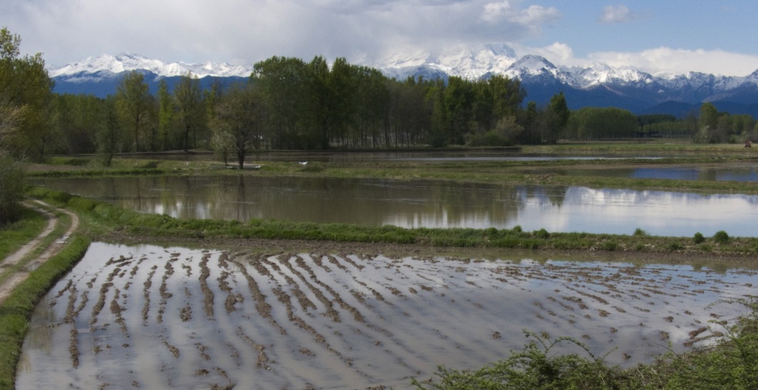
The baraggia of Vercelli and Biella extends for about 3000 ha in the provinces of Vercelli and Biella; the area is not contiguous, rather it consists of six subareas, which correspond to the territory of the Baragge Natural Oriented Reserve, instituted in 1992. The largest of these areas is the Baraggia of Piano Rosa, which constitutes the homonymous SCI of 1194 ha, and falls into the municipalities of Fontaneto d’Agogna, Romagnano Sesia, Ghemme, Cavallirio, Cavaglio d’Agogna and Sizzano in the province of Vercelli. The Baraggia of Candelo, also a SCI, of 604 ha, in the province of Biella, belongs to the municipalities of Candelo, Cossato, Mottalciata and Benna. The SCI Baraggia of Rosavenda, 1760 hectares, is found in Masserano, Brusnengo, Gattinara, Roasio, Rovasenda, Lenta e Lozzolo. The Baragge are significant as a historically persistent example of the management of the so-called incolto (uncultivated land). Many management systems have been adopted throughout the centuries, from semi-free range herding of goats, sheep, cattle and pigs, to the gathering of leaves, heather, dry wood, chestnuts, walnuts and mushrooms, to the management of coppice woods and the programmed cutting down of high forest trees. In the twentieth century a network of canals, stimulated rice growing also in the baraggia, which in the 1950s and 1970s were subject to a massive work of reclamation and agricultural transformation. The rice produced in the baraggia area obtained in 1992 the PDO label Rice of Baraggia Biellese and Vercellese. The integrity of the landscape of the baraggia is limited to a few areas, which were difficult to exploit for profitably cultivations. The area is highly vulnerable and much of the historical landscape has already been lost. The reclamation and the following interventions have significantly modified the area and greatly diminished the number of species found in the habitat of baraggia. The presence of military installations has favored the preservation saving them from plowing, but on the other hand has damaged the areas, due to explosions, fires and the passing of armored vehicles, which have eliminated the superficial humus stratum.
4. Wood of Sorti della Partecipanza di Trino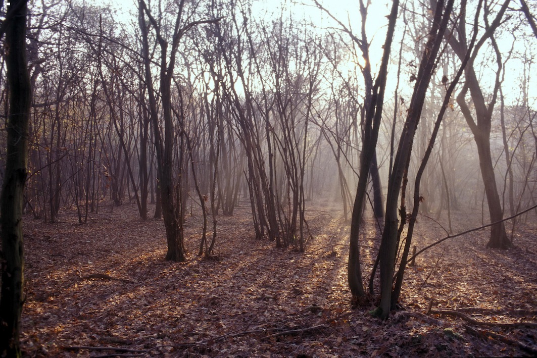
The area of the Bosco delle Sorti della Partecipanza di Trino (literally ‘Luck Woods of the Community of Trino’), is located in the municipalities of Trino, Ronsecco and Tricerro in an area of 1520 ha. On this area, the Natural Park Bosco delle Sorti della Partecipanza di Trino, was instituted in 1991. The significance of the area is the result of many elements mainly deriving from the historical persistence of the collective management tied to the Partecipanza. The woods is a mixed formation of oaks and hophornbeam and, to a lesser extent, of alders, closely connected to the neighboring rice paddies, which, by influencing the level of the water-bearing stratum also inside the woods, favor the temporary stagnation of water. The first historical news probably concern the last quarter of the thirteenth century, when the Marquis of Monferrato granted the inhabitants of Trino the right to use the woods as coppice. There is no doubt that this unusual system of collective management is the reason the woods escaped the agricultural transformations that have characterized the area. In the paddies around the woods the “Traditional rice of the Po valley” is produced, recognized as Traditional Food Product by the Ministry of Agricultural Alimentary and Forest Polices. The woods of the Partecipanza di Trino certainly retain their integrity, at least from the perspective of its extension. Every year, members have the right to cut the wood in a specific sector of the woods, which is further subdivided in a number of sub-areas called sorti or punti. At the moment there appear to be no elements of vulnerability.
5. The San Michele farmhouse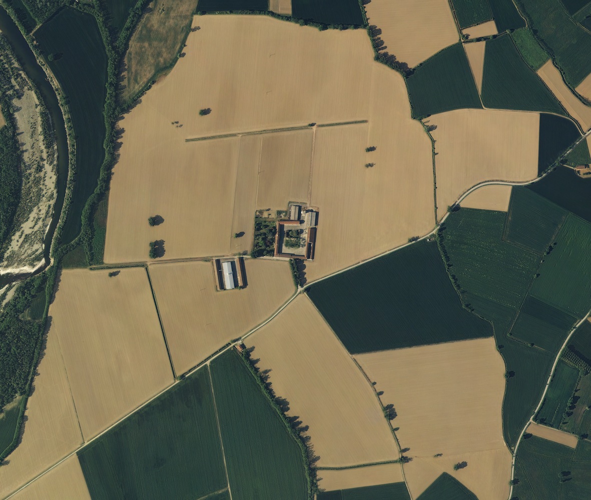
The typical landscape of the farmhouses (cascine) of the Alessandria area is found in a flat district of alluvial origin whose borders are marked by the rivers Bormida, Tanaro, Orba and Scrivia. The area of the Cascina San Michele, in the municipality of Bosco Marengo, and for a small part in the one of Casal Cermelli, extends for 236 ha. The significance of the area lies in the historical persistence of one of the typical farmhouses of the Alessandria plain, both in terms of the cultivations, mainly cereals and corn, and in the management of the farm. In 1566 the land of San Michele was acquired by the convent of S. Croce, established in Bosco Marengo by pope Pius V, and became one of the most important farms of the convent. The position of the residential building corresponds to late Renaissance architectural and agricultural criteria, which recommended that buildings face eastward. Its present layout is a result of additions made at various stages. Since 1966, the farm belongs to the family of Giovanni Mignone, which still lives on and manages the property. The integrity of the Cascina depends mainly on the existence of the building and on the continuation of farming, which in the last decades has become increasingly difficult. The area is vulnerable to changes in the cultivation system, which have already compromised the original aspect of the agrarian landscape. These transformations have involved most of the plain area and only a few residual elements of the historical agrarian landscape survive. Other potential dangers are possible changes to the buildings of the Cascina, which could alter their historical characteristics.
6. The wooded pastures of Roccaverano
The area corresponds to a selection of the pastures located in the south of the provinces of Asti and of Alessandria, for a total of 1098 ha, in the municipalities of Olmo Gentile, Roccaverano, Serole and Mombaldone. The significance of the area lies in the historical persistence of a landscape of vast open pastures, created by centuries of agro-silvo-pastoral practices. The pastures are mostly located at the top of the hills, while the steeper slopes, where many terraces are found, are nowadays used almost exclusively as vineyards and meadow-pastures. The local “robiola” cheese was assigned the PDO “Robiola di Roccaverano” and is also on the list of the Slow Food association. The integrity of the area has been largely maintained, and while the population has there has been steadily decreasing, especially since the 1960s, woods and scrubland have not completely replaced pastures. The pastures that are still used are still characterized by a complex environment, which translates into a high level of biodiversity. The greatest threat to the landscape of the pastures of Roccaverano lies in the abandoning of traditional activities associated with shepherding and to its direct consequences. On the slopes no longer used as pasture, woods began expanding already towards the end of the nineteenth century, replacing fields and vineyards, whose combined presence is attested towards the mid-nineteenth century.
7. Historical plycultures of Valle Uzzone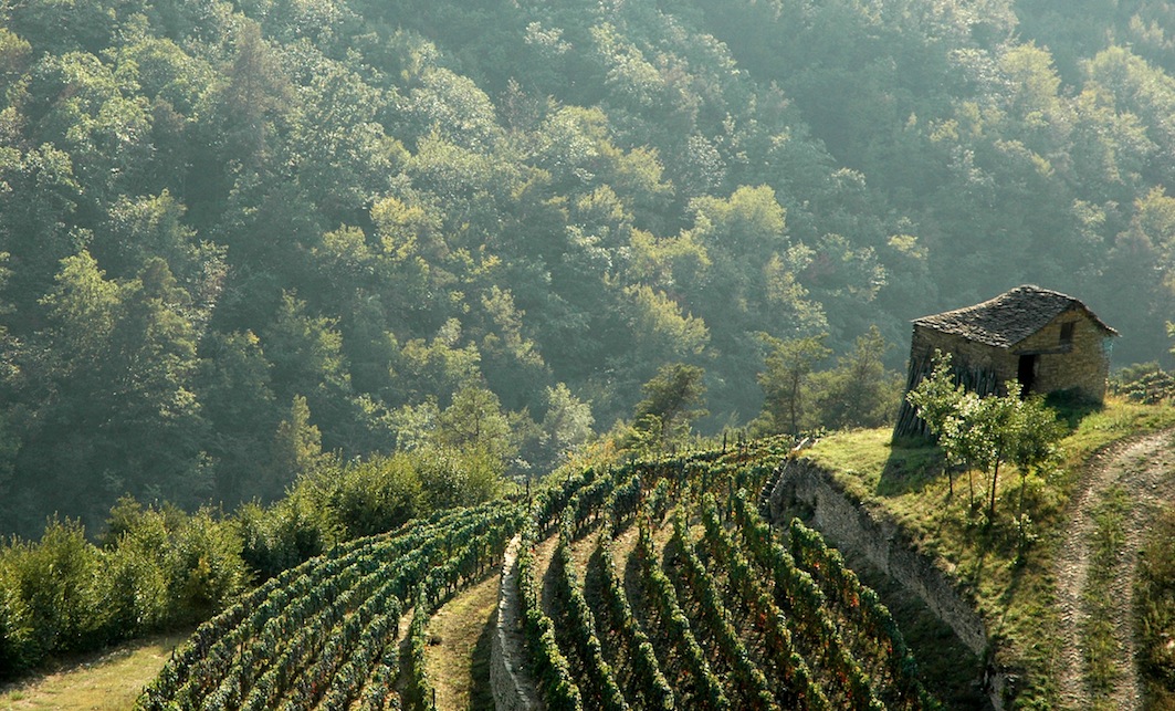
The traditional polyculture areas of Valle Uzzone, in the municipalities of Castelletto Uzzone, Pezzolo Valle Uzzone, Prunetto and Levice, extends for 939 ha. The significance of the area lies in the historical persistence of polyculture, which create a composite and perfectly balanced landscape, in which small agricultural areas alternate with wooded areas and meadows, enriched by historical settlements and terraced slopes. Cultivations include cereals, vegetables, vine and fruit. Other typical products include Robiola cheese, eggs, dried chestnuts and wool. A small number of cattle are also farmed, and used for milk, meat and in the past as work-animals. The structure of the historical landscape, based on the farmhouse and the surrounding mosaic of cultivations, is patterned by the succession of settlements, gathered around castles or feudal palaces, and framed by the calanchi gullies at the bottom of the valleys, the chestnut groves at the top of the hills, and the lines of terraces that connect the entire system. The scenery of Valle Uzzone has basically retained its integrity and its historical identity can be easily perceived, except in some areas at the bottom of the valley where new settlements have developed. Polyculture, though less complex than in the past, is still present in many areas, and ensures the preservation of an aesthetic and cultural heritage that would otherwise be lost forever. The greatest threats lie in the abandoning of traditional practices. There have also been notable changes in the structure of the cultivations (from polyculture for personal use to cultivations produced mainly for the market: cereals, hazel-nut groves, hay).
8. The Galarei vineyard
The holding Tenuta of Fontanafredda, where Galarei Vineyard is located, extends for about 100 ha in the municipalities of Serralunga d’Alba and Diano d’Alba. The area is quite small, but it is significant not only for the historical value of the holding and of the cultivations, but also because of a vineyard of 0,37 ha called Vigna Galarei, which is of particular historical interest. The name comes from the woods of Gallareto, eliminated in the mid-nineteenth century to make room for the vineyard, while the denomination refers to an old well dug by hand and shaped like a demijohn. It is a tiny fragment in a territory where modern specialized viticulture has profoundly altered the landscape. Its importance lies in its historical value and in its preservation ensured by a winery that has a long-standing tradition especially in the production of Barolo one of the most important and well known Italian red wines. Specialized viticulture appears to have been systematically introduced only in the last three decades of the eighteenth century: previously vine was cultivated in a quite different fashion, the main system being that of the vite maritata (wedded vine) of Etruscan origin, in which trees are used to support the vine which is attached at a high level. Besides the vineyards, an important element is the Bosco dei Pensieri, which extends for 6 ha, a wood that has been endowed with a didactic itinerary with many panoramic spots and panels with literary and historical comments on the environment and landscape of the Langhe area. The wines produces inside the holding are of outstanding quality and include the Barolo DOCG (Controlled and Guaranteed Origin Denomination), the Dolcetto d’Alba DOC (Controlled Origin Denomination), the Moscato d’Asti DOC and the Nebbiolo DOC. The landscape of the holding of Fontanafredda maintains only small fragments of the historical characteristics of the vineyards of the Langhe area.


